
Guy Shrubsole@guyshrubsole
Aug 2, 2022
12 tweets
In deepest darkest Devon, I’ve found what I think is a fragment of Atlantic hazelwood: a type of temperate rainforest & a very rare habitat, more usually found in western Scotland or Ireland. Let me tell you a bit about it…  1/n
1/n
1/n 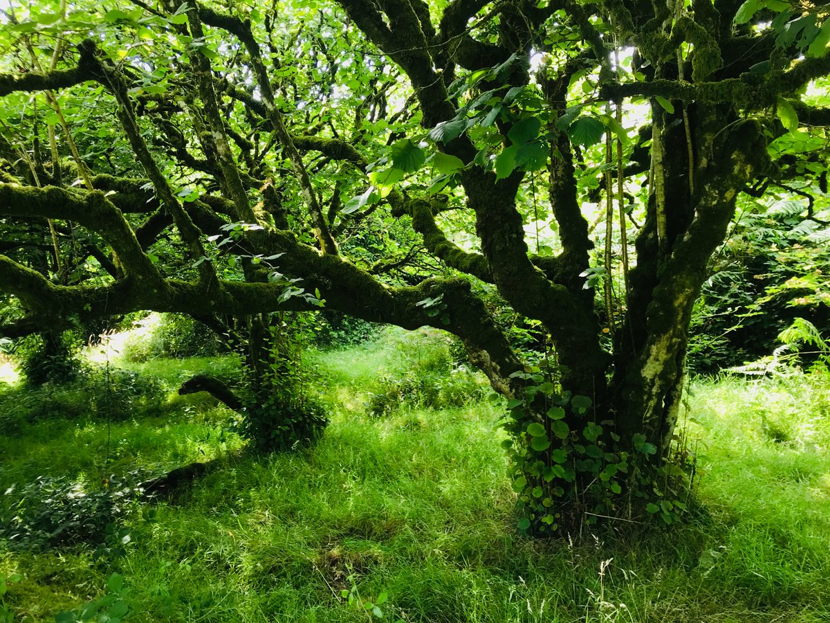
On Dartmoor’s eastern edge, north of Sampford Spiney, is a hidden valley. Here, veteran hazel trees grow like no other hazel you’ve seen: thick-boughed and gnarled, encrusted with mosses and lichens. Nothing like the coppiced hazels we're used to in hedgerows. 2/n


Guy Shrubsole@guyshrubsole
Aug 02 22
View on Twitter
On Dartmoor’s eastern edge, north of Sampford Spiney, is a hidden valley. Here, veteran hazel trees grow like no other hazel you’ve seen: thick-boughed and gnarled, encrusted with mosses and lichens. Nothing like the coppiced hazels we're used to in hedgerows. 2/n
Epiphytes grow in profusion on these hazels, like the translucent polypody ferns, and String-of-sausages lichen (Usnea articulata), which festoons whole branches. 3/n


The hazel trees here also abound in Sticta lichens: a bizarrely fish-smelling group of lichen species that love temperate rainforests and damp woods. Here are three examples of Sticta fulignosa growing on the hazels, and one of (I think) Sticta limbata. 4/n


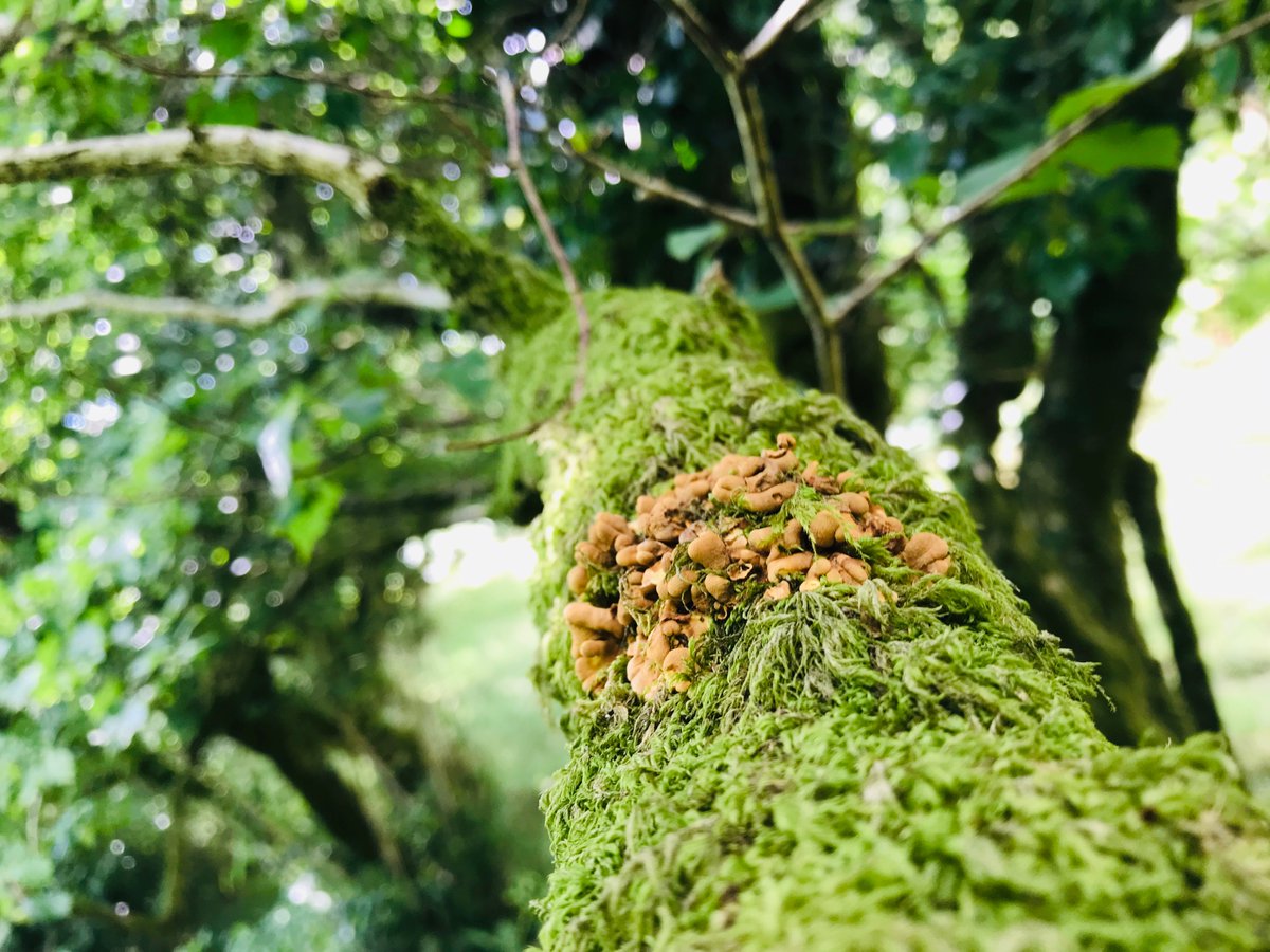
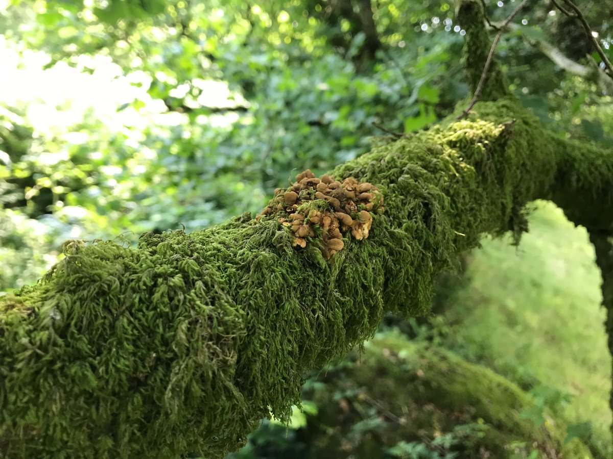
Most excitingly of all, I recently found Hazel Gloves fungus growing there (Hypocreopsis rhododendri). This fantastically weird species is only found in temperate rainforests, mostly in western Scotland – but as @Billy Fullwood has shown, also in the Westcountry. 5/n
These groves of veteran hazels with their rich covering of epiphytes have clearly been growing here for some time. Some of the oakwoods in this valley are shown on England’s Ancient Woodland Inventory, & on 1st edition OS maps from 1809 (see digitalarchive.mcmaster.ca/islandora/obje). 6/n


However, the hazel groves I found lie outside the areas marked as Ancient Woodland, and don’t show up on the 1st ed OS maps.
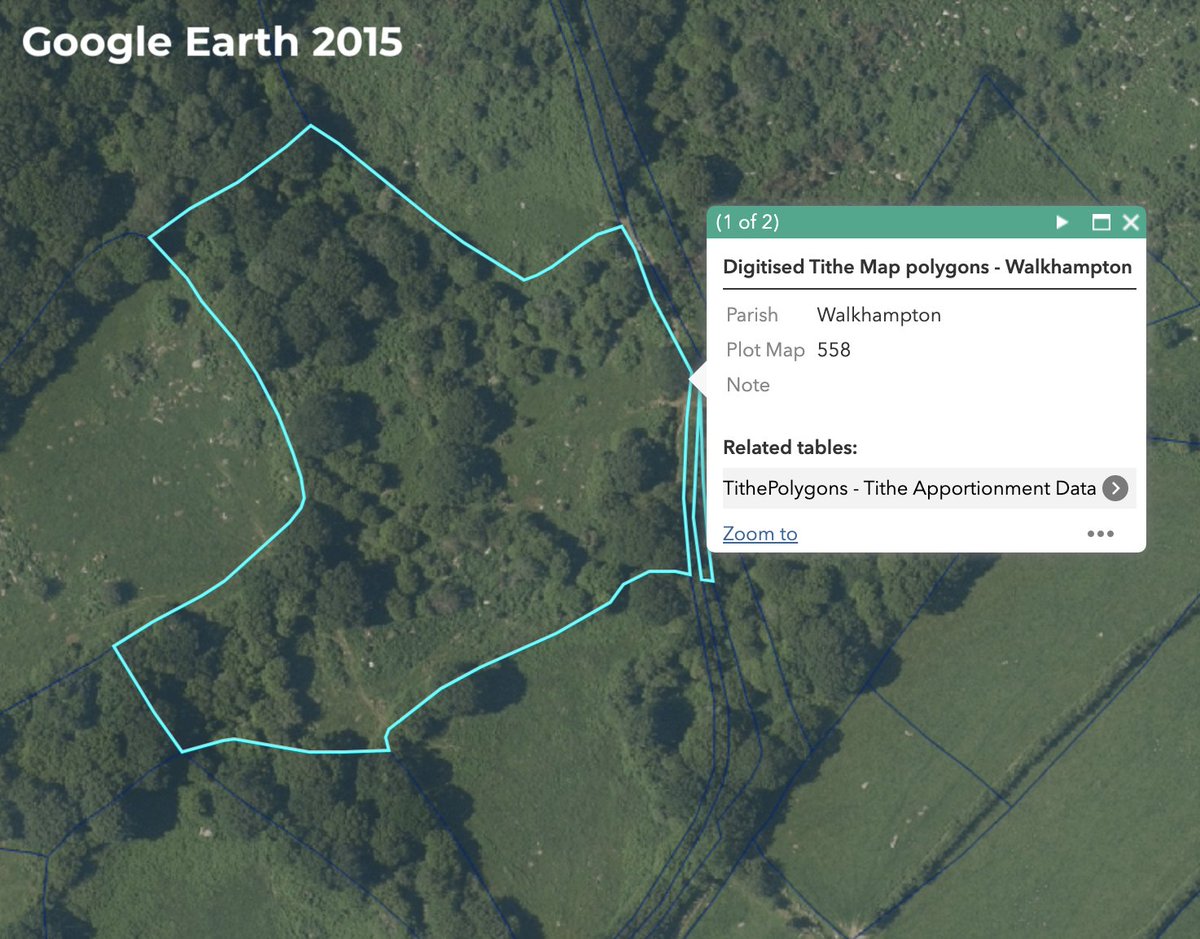
And by examining 1834 Tithe maps (see maptest.devon.gov.uk/portaldvl/apps) we can see that much of what is wooded today was pasture & even arable 200 years ago. 7/n


In fact, we can use old maps to see how today’s veteran hazels are likely the result of 200 years of natural regeneration.
1834 Tithe map records a pasture field; 1880 OS map shows scrub and furze; 1952 OS map shows scrub and trees. Maps from maps.nls.uk 8/n


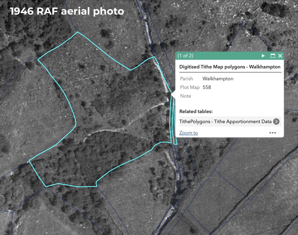
We can also use more recent aerial imagery to chart how the hazel groves have grown.
1946 RAF aerial fly-by; Google Earth images from 1999, 2006 and 2015. 9/n


These old hazel groves lie outside the nearby Sampford Spiney SSSI.
Indeed, three-quarters of England’s temperate rainforests lack such legal protections theguardian.com/environment/20
I hope @Natural England will consider extending the SSSI boundary to cover these Atlantic hazelwoods.

(End of thread)
Erratum: Sampford Spiney is on Dartmoor's western edge, not eastern. Sorry!
Coda: wow, this blew up! If you’d like to read more about Britain’s lost rainforests, please pre-order my book, out this October: twitter.com/guyshrubsole/s
Guy Shrubsole@guyshrubsole
Jul 04 22
View on Twitter
Incredibly excited to reveal the cover of my next book, THE LOST RAINFORESTS OF BRITAIN - by the sublime Tolkien illustrator Alan Lee!
Featuring Welsh wizards, mossy trees, Celtic myths & lichens galore, my book's out on 27th October. Pre-order here: amazon.co.uk/Lost-Rainfores


Guy Shrubsole
@guyshrubsole
Environmental campaigner & author, 'Who Owns England?' (2019). Now writing ‘The Lost Rainforests of Britain’ (William Collins, out Oct 2022). Agent @JMLockhart2
Missing some tweets in this thread? Or failed to load images or videos? You can try to .