
NASA Climate@NASAClimate
Sep 23, 2022
7 tweets
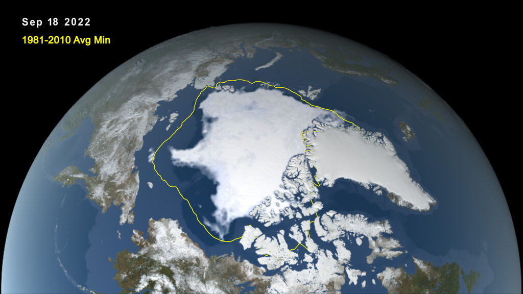
Arctic sea ice reaches its low point – known as the Arctic sea ice minimum – every year in mid-September. This year tied for the 10th-lowest sea ice extent since year-round satellite records began in 1979, continuing a long-term downward trend.
Sea ice is frozen seawater that floats on the ocean surface. Since 1979, Arctic sea ice has shrunk by 32 percent.
This graph shows the extent of the ice each year in September.
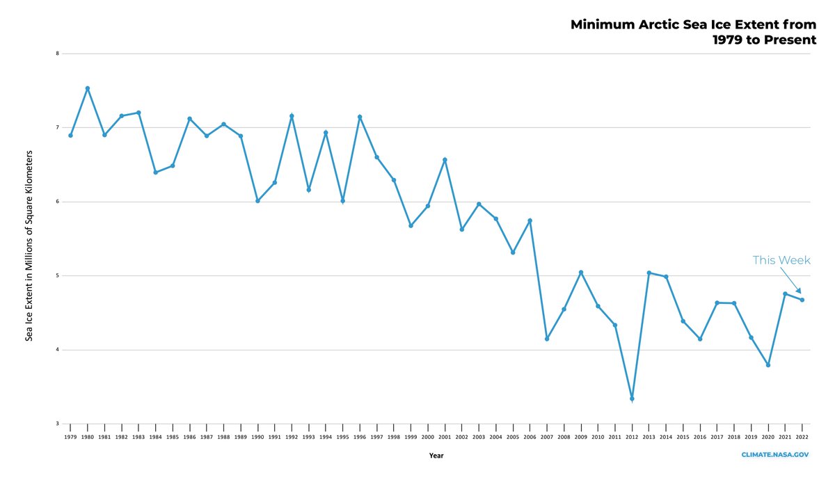
The ice is getting thinner, too, as areas of older, thicker ice are melting and being replaced with “seasonal ice” that melts and refreezes each year. In general, thinner ice is more vulnerable to breaking apart from wind and weather: climate.nasa.gov/news/2817/with

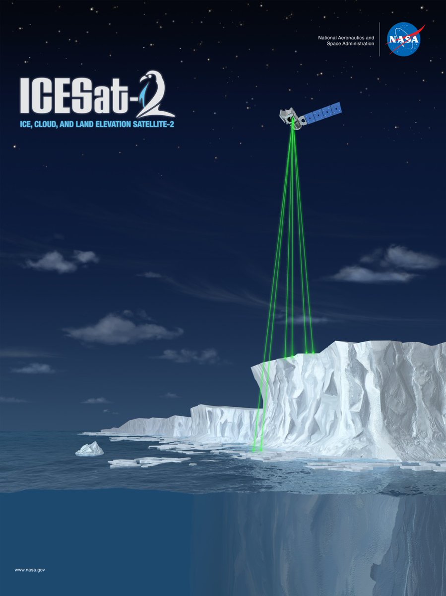
How do we measure sea ice? With space lasers, of course! NASA’s ICESat-2 satellite sends laser beams to Earth. ICESat-2 measures how long it takes for a laser pulse to bounce off Earth’s surface and return to the satellite; this tells us the elevation of the ocean water or ice.
Why do we care? Because white ice reflects sunlight, which keeps the planet cooler. Snow and ice can be thought of as Earth’s natural air conditioning.
Indigenous cultures and Arctic animals also depend on sea ice. Ice loss has cascading, negative effects throughout ecosystems.
As we head into winter, Northern Hemisphere sea ice will begin to grow again. You can track its progress here: earth.gsfc.nasa.gov/index.php/cryo
Wondering about the opposite end of the globe? Since it’s winter in Antarctica, sea ice is near its yearly peak. So far in 2022, Antarctic sea ice is shaping up to be among the lowest years on record.
Learn more about sea ice and Earth’s vital signs: climate.nasa.gov/vital-signs/ar


NASA Climate
@NASAClimate
Understanding our planet to benefit humankind
Find us at https://t.co/KaKUU3H79Q and https://t.co/c9lqAKrvUe.
Missing some tweets in this thread? Or failed to load images or videos? You can try to .