
Tomer Burg@burgwx
Sep 23, 2022
10 tweets
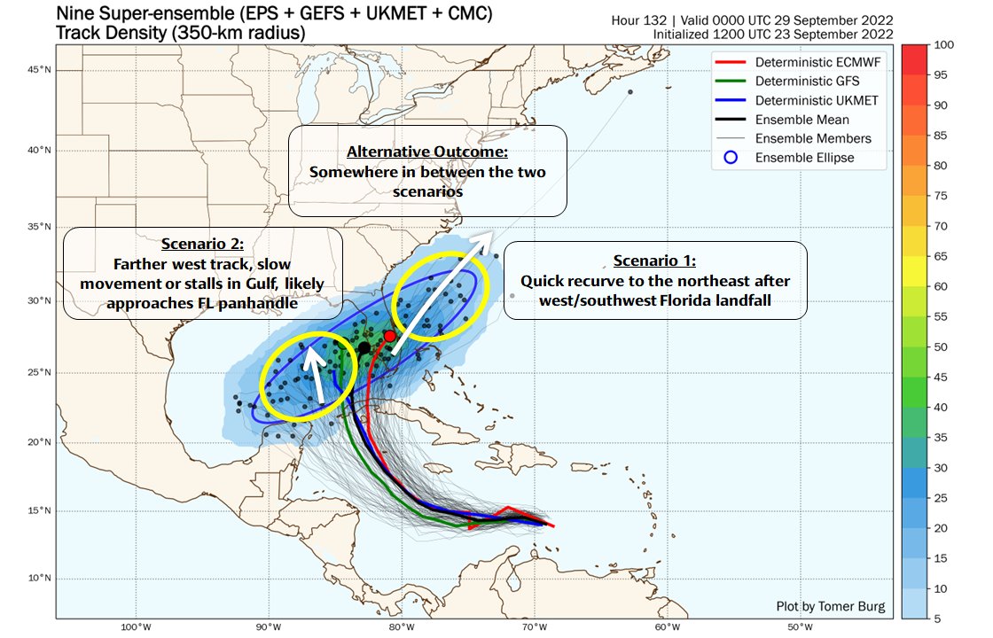
[#MeteorologyAnalysis] Let's take a deeper look into the forecast track uncertainty with Tropical Depression 9.
The majority of ensemble members can be generally split into 2 scenarios:
- TD #9 quickly recurves & tracks up East Coast
- TD #9 slows down in eastern Gulf
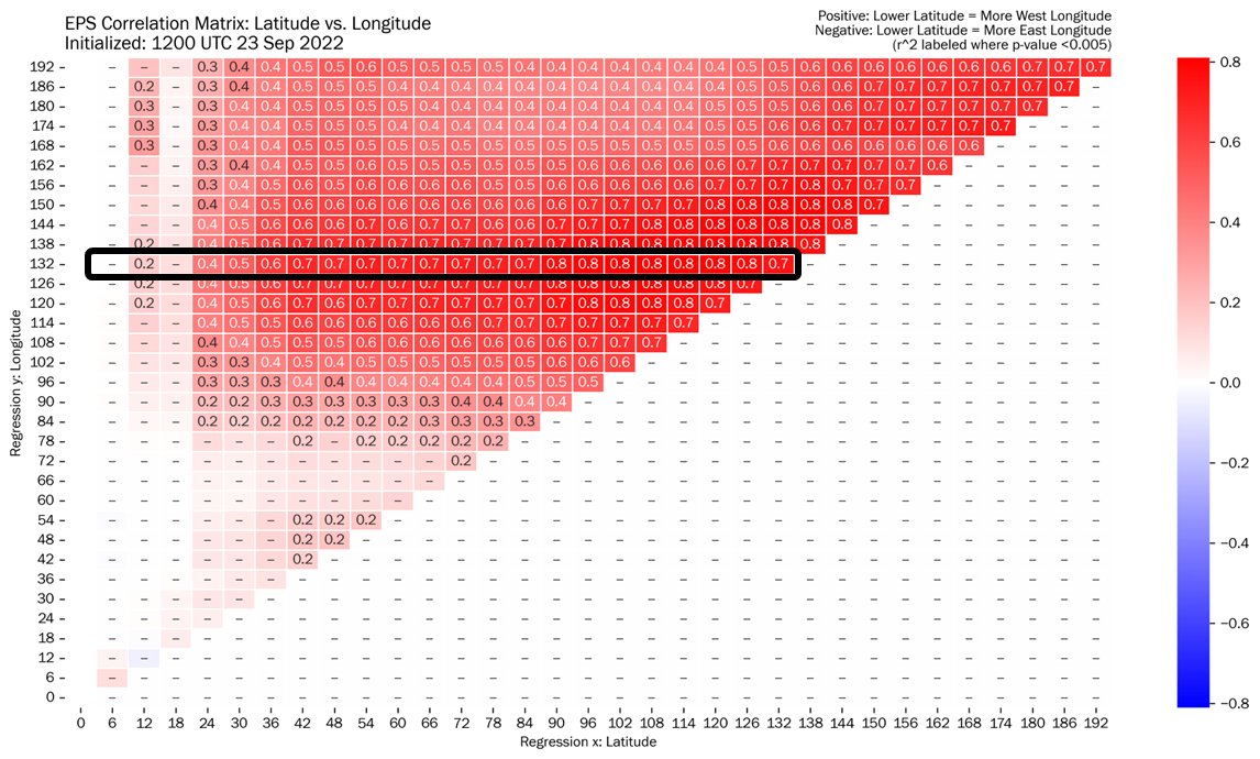
One of the sources of forecast uncertainty is TD 9's short-term evolution itself.
We can see that short-term latitude strongly correlates with longer-term longitude - meaning a further south TD 9 in the short term tends to track farther west in the Gulf of Mexico.
Why is the longitude at which TD 9 arrives in the Gulf important?
Forecast track spread hits an inflection point here - a farther north/east TD 9 is more likely to be picked up by a deep NE US trough, while a more south/west TD 9 is more likely to miss the trough.
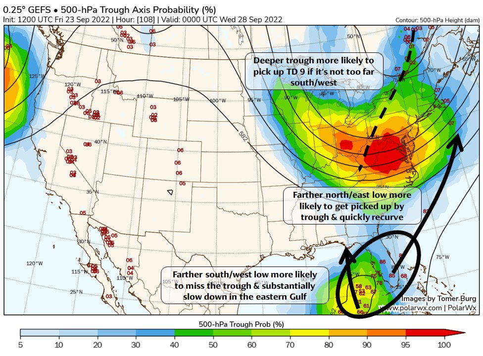
The trough itself is an important part of the equation too.
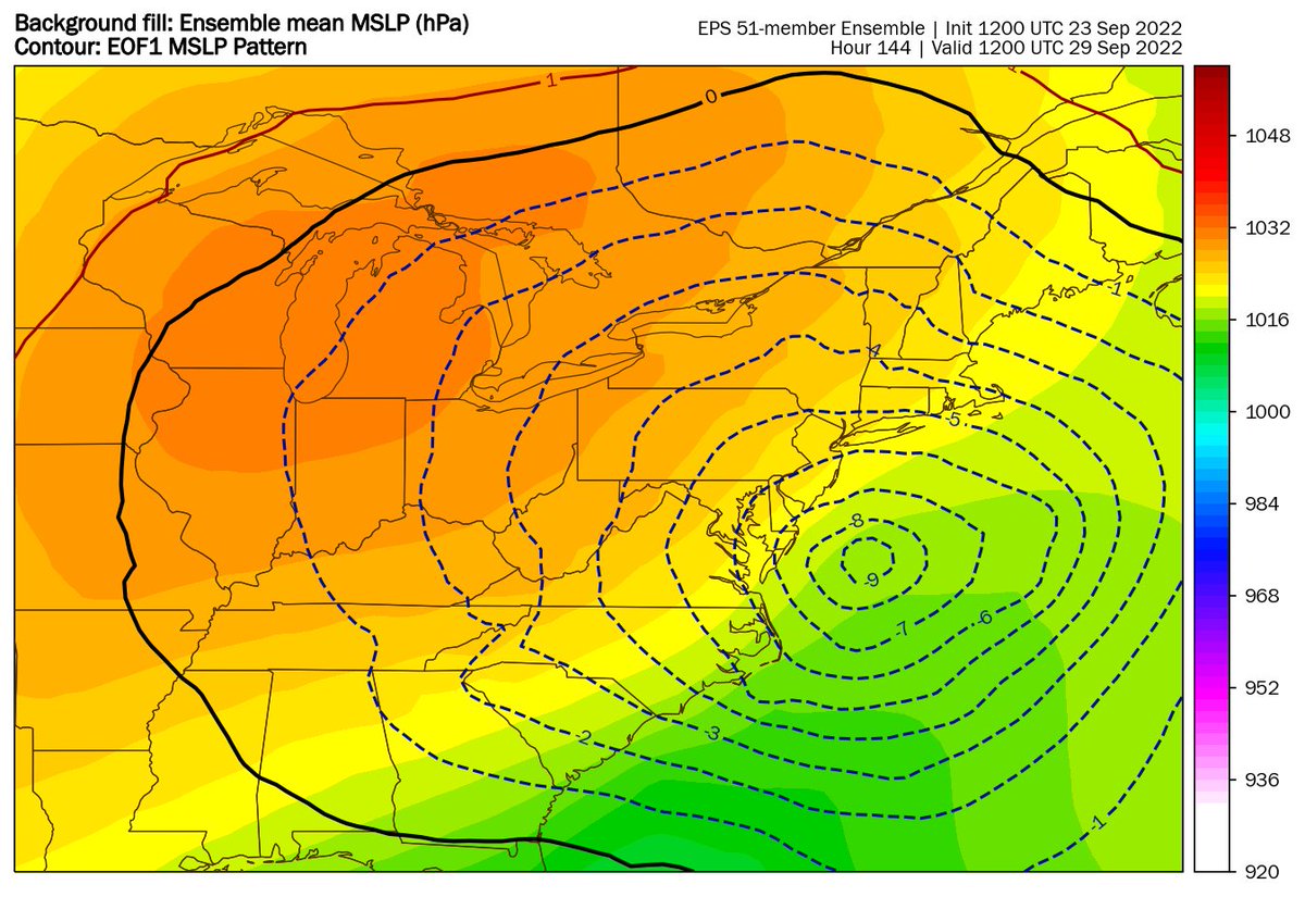
The EPS have been consistently east of the GEFS & more inclined to recurve. Notice how the EPS not only have TD 9 farther east, but also have a deeper & slower NE US trough:
What can help us examine the uncertainty with the NE US trough?
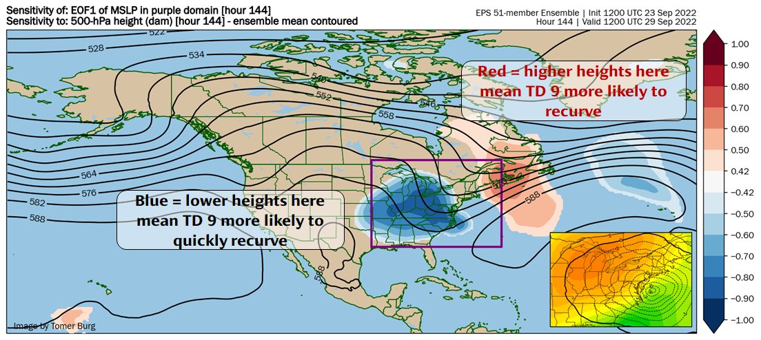
We'll use Ensemble Sensitivity Analysis (ESA) to further diagnose this. The leading mode of MSLP variability is TD 9's location, which we can also interpret as whether/how quickly TD 9 recurves.
Interpreting ESA plots can be quite challenging, so I annotated this plot to better help.
This says at hour 144, to get a quickly recurving TD 9, we need a deeper & slower NE US trough, with more ridging downstream.
This matches what we showed earlier with EPS vs. GEFS.
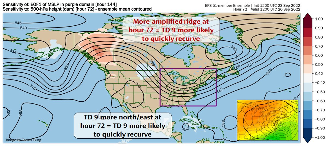
To further illustrate this concept, let's now see how 500mb heights at hour 72 correlate with TD 9's location at hour 144.
For a quickly recurving TD 9, we'd need (a) more amplified NW Canada ridge, and (b) TD 9 more north/east.
Looping ESA through earlier lead times, the picture becomes clear - a Rossby wave packet (RWP) amplifying the US waveguide results in the deep NE US trough that may or may not pick up TD 9.
A more amplified RWP than modeled increases likelihood of a quick recurve.
Key takeaway points:
 Monitor TD 9's short-term track: farther north/east = more likely to quickly recurve
Monitor the RWP over the NE Pacific in the next few days: more amplified -> quicker recurve more likely
Opposite of these favors slow-moving TD 9 in eastern Gulf
Monitor TD 9's short-term track: farther north/east = more likely to quickly recurve
Monitor the RWP over the NE Pacific in the next few days: more amplified -> quicker recurve more likely
Opposite of these favors slow-moving TD 9 in eastern Gulf
Monitor TD 9's short-term track: farther north/east = more likely to quickly recurve
Monitor the RWP over the NE Pacific in the next few days: more amplified -> quicker recurve more likely
Opposite of these favors slow-moving TD 9 in eastern GulfI realize this thread is an intense read for those less familiar with the inner workings of meteorology - if I feel up for it I might make a quick public-oriented video on TD #9 later tonight, if not then at some point tomorrow.

Tomer Burg
@burgwx
Atmospheric Science Ph.D. candidate at OU, living in NYC | M.S. & B.S. from @UAlbanyDAES | somewhat active for hurricane season
Missing some tweets in this thread? Or failed to load images or videos? You can try to .